Simulate
Plan geometry, detector positions and expected measurement response.

See inside. Understand more.

MuonOS connects planning, detector operations, reconstruction, visualisation and reporting in one traceable workflow for muon imaging projects.
One connected environment
Muon imaging produces its greatest value when survey design, field context, detector data and technical interpretation remain connected. MuonOS provides that continuity.
Teams can assess a proposed geometry before deployment, collect traceable measurements in the field, process and explore results in the cloud, and produce outputs linked to the underlying evidence.
Plan geometry, detector positions and expected measurement response.
Control field acquisition and maintain a traceable project record.
Reconstruct and explore density information in the cloud.
Turn interpreted results into controlled engineering outputs.
Platform products
Open each panel to explore how MuonOS supports investigation planning, field delivery, cloud interpretation and reporting.
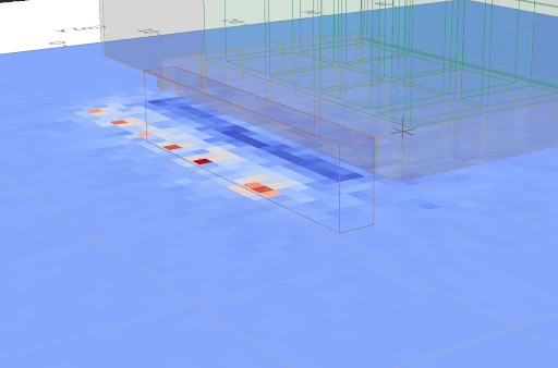
MuonOS Simulate provides a browser-based environment for designing a muon imaging investigation before equipment reaches the site. Import representative CAD, BIM or geological geometry, define the target volume and physical constraints, and position virtual detectors around the structure or subsurface feature. The platform simulates muon trajectories and the expected measurement response so alternative layouts, viewing angles and collection strategies can be compared before deployment. This reduces uncertainty in survey design, helps avoid costly repositioning on site and establishes whether the proposed geometry and acquisition time can answer the engineering question.
Foundation access supports core simulation and guided planning for individual projects. Delivery access adds richer geometry workflows, scenario comparison and tools for teams running investigations repeatedly. Enterprise access supports governed multi-user operation, deeper integrations and advanced export requirements.
Discuss MuonOSTiered access
Start with the capabilities needed for a defined project and extend the platform as delivery frequency, team size and governance requirements grow.
Individual projects
Core planning, field collection, cloud processing and project reporting for teams undertaking a defined muon investigation.
Recurring programmes
Richer project, comparison and operational tools for organisations delivering repeated surveys or managing a growing evidence base.
Governed deployment
Controlled multi-user access, auditability and integration pathways for organisations operating MuonOS at scale.
Controlled technical delivery
Project geometry, field metadata, measurements, reconstruction and outputs remain connected throughout the investigation.
Geoptic specialists and authorised project teams can work from a shared technical record rather than disconnected files.
Tiered access supports a route from individual investigations to repeat delivery and governed enterprise use.

Contact Geoptic to discuss your investigation, system requirements and the right MuonOS access tier for your team.